The Climate Change Facts You Need to Know

This week, world leaders are converging in Paris to talk about climate policy. Under current guidelines, the planet is on target to warm by 2 degrees Celsius in 2050 and by 4 degrees in 2100, triggering serious large-scale problems by the end of the century.

“Drought, heat waves, forest fires — we are already seeing this,” says V. Ramanathan, an atmospheric scientist.

Ramanathan, who will be speaking at the conference, accurately predicted this trend back in 1980. In the video above, he explains how we might be able to change our course on climate.

Small volcanic eruptions explain warming hiatus

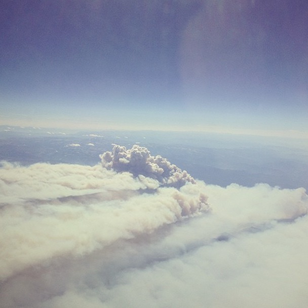
Scientists have long known that volcanoes cool the atmosphere because of the sulfur dioxide that is expelled during eruptions. Droplets of sulfuric acid that form when the gas combines with oxygen in the upper atmosphere can persist for many months, reflecting sunlight away from Earth and lowering temperatures at the surface and in the lower atmosphere.

Previous research suggested that early 21st-century eruptions might explain up to a third of the recent warming hiatus.

New research available online in the journal Geophysical Research Letters (GRL) further identifies observational climate signals caused by recent volcanic activity. This new research complements an earlier GRL paper published in November, which relied on a combination of ground, air and satellite measurements, indicating that a series of small 21st-century volcanic eruptions deflected substantially more solar radiation than previously estimated.

“This new work shows that the climate signals of late 20th- and early 21st-century volcanic activity can be detected in a variety of different observational data sets,” said Benjamin Santer, a Lawrence Livermore National Laboratory scientist and lead author of the study.

The warmest year on record is 1998. After that, the steep climb in global surface temperatures observed over the 20th century appeared to level off. This “hiatus” received considerable attention, despite the fact that the full observational surface temperature record shows many instances of slowing and acceleration in warming rates. Scientists had previously suggested that factors such as weak solar activity and increased heat uptake by the oceans could be responsible for the recent lull in temperature increases. After publication of a 2011 paper in the journal Science by Susan Solomon of the Massachusetts Institute of Technology, it was recognized that an uptick in volcanic activity might also be implicated in the warming hiatus.

Prior to the 2011 Science paper, the prevailing scientific thinking was that only very large eruptions — on the scale of the cataclysmic 1991 Mount Pinatubo eruption in the Philippines, which ejected an estimated 20 million metric tons (44 billion pounds) of sulfur — were capable of impacting global climate. This conventional wisdom was largely based on climate model simulations. But according to David Ridley, an atmospheric scientist at MIT and lead author of the November GRL paper, these simulations were missing an important component of volcanic activity.

Ridley and colleagues found the missing piece of the puzzle at the intersection of two atmospheric layers, the stratosphere and the troposphere — the lowest layer of the atmosphere, where all weather takes place. Those layers meet between 10 and 15 kilometers (6 to 9 miles) above the Earth.

Satellite measurements of the sulfuric acid droplets and aerosols produced by erupting volcanoes are generally restricted to above 15 km. Below 15 km, cirrus clouds can interfere with satellite aerosol measurements. This means that toward the poles, where the lower stratosphere can reach down to 10 km, the satellite measurements miss a significant chunk of the total volcanic aerosol loading.

To get around this problem, the study by Ridley and colleagues combined observations from ground-, air- and space-based instruments to better observe aerosols in the lower portion of the stratosphere. They used these improved estimates of total volcanic aerosols in a simple climate model, and estimated that volcanoes may have caused cooling of 0.05 degrees to 0.12 degrees Celsius since 2000.

The second Livermore-led study shows that the signals of these late 20th and early 21st eruptions can be positively identified in atmospheric temperature, moisture and the reflected solar radiation at the top of the atmosphere. A vital step in detecting these volcanic signals is the removal of the “climate noise” caused by El Niños and La Niñas.

“The fact that these volcanic signatures are apparent in multiple independently measured climate variables really supports the idea that they are influencing climate in spite of their moderate size,” said Mark Zelinka, another Livermore author. “If we wish to accurately simulate recent climate change in models, we cannot neglect the ability of these smaller eruptions to reflect sunlight away from Earth.”

To see the full research, go to Geophysical Research Letters and the Wiley Online Library.

The Livermore-led research involved a large interdisciplinary team of researchers with expertise in climate modeling, satellite data, stratospheric dynamics, volcanic effects on climate, model evaluation, statistics and computer science. Other Livermore contributors include Céline Bonfils, Jeff Painter, Francisco Beltran and Gardar Johannesson. Other collaborators include Solomon and Ridley of MIT, John Fyfe at the Canadian Centre for Climate Modeling and Analysis, Carl Mears and Frank Wentz at Remote Sensing Systems and Jean-Paul Vernier at the NASA/Goddard Space Flight Center.

West Antarctic glacier loss appears unstoppable

A rapidly melting section of the West Antarctic Ice Sheet appears to be in irreversible decline, with nothing to stop the entire glacial basin from disappearing into the sea, according to researchers at UC Irvine and NASA.

The new study presents multiple lines of evidence — incorporating 40 years of observations that six massive glaciers in the Amundsen Sea sector “have passed the point of no return,” according to glaciologist Eric Rignot, a UC Irvine Earth system science professor who is also with NASA’s Jet Propulsion Laboratory. The new study has been accepted for publication in Geophysical Research Letters, a journal of the American Geophysical Union.

These glaciers already contribute significantly to sea level rise, releasing as much ice into the ocean each year as the entire Greenland Ice Sheet does. They contain enough ice to boost the global sea level by 4 feet (1.2 meters) and are melting faster than most scientists had expected. Rignot said the findings will require that current predictions of sea level rise be revised upward.

“This sector will be a major contributor to sea level rise in the decades and centuries to come,” Rignot said. “A conservative estimate is that it could take several centuries for all of the ice to flow into the sea.”

Three lines of evidence

Three major lines of evidence point to the glaciers’ eventual demise: changes in their flow speeds, how much of each glacier floats on seawater, and the slope and depth below sea level of the terrain they’re flowing over. In a paper published last month, the research group showed that the speed at which the glaciers are moving has accelerated steadily for four decades, increasing the amount of ice draining from them by 77 percent from 1973 to 2013. This new study focuses on the other two lines of evidence.

The West Antarctic glaciers flow out from land over the ocean, with their front edges afloat. The point at which they lose contact with land is called the grounding line. Virtually all glacial melting occurs on the undersides of their floating sections — beyond the grounding line.

Just as a boat that’s run aground can float again if its cargo is unloaded, a glacier can float over an area where it used to be grounded if it becomes lighter, which it does by melting or by stretching out and thinning. The Antarctic glaciers studied by Rignot’s group have shrunk so much that they’re now floating above places where they used to sit solidly on land, which means the grounding lines are retreating inland.

They’re “buried under a thousand or more meters of ice, so it’s incredibly challenging for a human observer on the ice sheet surface to figure out exactly where the transition is,” Rignot said. “This analysis is best done via satellite techniques.”

The team used radar observations from the European Remote Sensing satellites (ERS-1 and ERS-2) between 1992 and 2011 to map the grounding lines’ inland creep. The satellites employ a method called radar interferometry that enables scientists to measure very precisely — within a quarter of an inch — how Earth’s surface is moving. Glaciers shift horizontally as they flow downstream, but their floating portions also rise and fall with changes in the tides. Rignot and his group mapped how far inland these vertical motions extend to locate the grounding lines.

Vicious cycle

The accelerating flow speeds and retreating grounding lines reinforce each other in a recurring loop. As glaciers move faster, they stretch out and thin, which decreases their weight and lifts them farther off the bedrock. As the grounding line retreats and more of the glacier becomes waterborne, there’s less resistance underneath, so the flow accelerates, and so on — with each action intensifying the next.

Slowing or stopping these changes requires “pinning points” — bumps or hills rising from the glacier bed that snag the ice from below. To locate them, researchers produced a more accurate map of bed elevation that combines ice velocity data from ERS-1 and ERS-2 and ice thickness data from NASA’s Operation IceBridge mission and other airborne campaigns. The results confirmed that just one pinning point remains upstream of the current grounding lines. Only Haynes Glacier has major bedrock obstructions upstream, but it drains a small sector and is retreating as rapidly as the other glaciers.

Bed topography is another key to the fate of the ice in this basin. All the glacier beds slope deeper below sea level as they extend inland. As they retreat, they cannot escape the ocean’s reach, and the relatively warm water melts them even more rapidly.

The accelerating flow rates, lack of pinning points and sloping bedrock all point to one conclusion, Rignot said:

“The collapse of this sector of West Antarctica appears to be unstoppable. The fact that the retreat is happening simultaneously over a large sector suggests it was triggered by a common cause, such as an increase in the amount of ocean heat beneath the floating parts of the glaciers. At this point, the end appears to be inevitable.”

Could cherry blossoms one day be blooming in winter?

Chery Blossoms

The cherry blossoms in Washington D.C.’s annual festival now bloom five days earlier than when the festival was celebrated in 1921 (on average). Scientists theorize that with the drastic warming of the globe, future decades could see blossom times not just a few days early but advanced by almost a month.

To better understand the situation, researchers need large amounts of data about different all types of plants in order to analyze. Gathering all of this data is not easy.

UC Santa Barbara’s Susan Mazer explains why researchers need the public’s help to gather this information:

Facebook for Nature

Can a status update from a tulip tell us anything about climate change?

The science of seasonal observation has always mattered, but never has it been so urgent. Each year, our seasons unfold. Perhaps they feel the same to us each time, or maybe we notice the slight differences. A lack of rain in the west, and a barrage of snow in the east. Flowers are blooming earlier, fruit is ripening sooner. OK, so what’s the big deal with some slightly confused flora? Well, that confusion ripples outward, and that matters because of how beholden all living things are to other living things. The timing of our ecosystem, complicated as it is in the most ideal of times, is off-kilter.

The California Phenology Project, a collaboration between UC Santa Barbara, the National Park Service, and The National Phenology Network endeavors to document plant ranges, flowering dates, and other relevant data to assess climate change responses throughout the state of California. In the UC Natural Reserve System there are 3,300 plant species. The list reads like a poem of plants you may have never heard of: Awned Fescue, Ripgut Grass, Winecup Clarkia. The idea is that when these plants bloom within the season (and how that differs year to year) is actually a clue, indicative of the world they are blossoming into.

The phenological observations of scientists and citizens alike will all contribute to the Pheonology Project’s online resource, Nature’s Notebook, a kind of Facebook for Nature (I would totally friend request the California Poppy, golden and archetypal as it is, and Winecup Clarkia too, in all its hot pink, magenta splendor). But unlike the existential quandaries posed by the ubiquitous social media site, this online notebook will begin to reveal some of the patterns of our natural world and what that might mean for us. Since the task at hand is too large for just the professional scientists, now is the chance for people to reconnect with their environment and become contributors to this project, citizen-scientists observing and noting the plant species in Golden Gate Park or in their own backyard. We are all capable of phenological observation. The California Poppy accepts your friendship request! What will you do now?

Enjoy the video?  Subscribe to our new channel on YouTube!

Into the Wildfire

Picture 2013-09-26 at 4.19.52 PM

Researchers at Los Alamos National Laboratories and elsewhere are investigating other aspects of fire propagation, like how big fires create their own weather — a process that has contributed to some of the most devastating fires in recent years.

The setup in the photo above is known as a “fire-whirl generator” and is used to better understand the physics of a flame.

Read more about fire science here

Urban heat islands – why is it warmer in the city?

urbanheatisland

Summer in the city can be especially hot and sticky, because urban heat islands exacerbate the warm weather. Researchers at Berkeley Lab are testing materials that battle that effect, making pavements cooler and safer.

Causes

The properties of urban roofs and pavements, as well as human activity, contribute to the formation of summer urban heat islands:

  • Urban surface properties. Roofs and pavements can constitute about 60% of the surface area of a U.S. city. These surfaces are typically dark in color and thus absorb at least 80% of sunlight, causing them to get warmer than lighter colored surfaces.1 These warm roofs and pavements then emit heat and make the outside air warmer.
  • Human activity. Air conditioning, manufacturing, transportation, and other human activities discharge heat into our urban environments.

Consequences

Urban heat islands can negatively affect the urban community and the environment.

  • Increased energy use. Warm temperatures in cities increase the need for air conditioning (A/C) to cool buildings. This elevated demand can strain the electrical grid on a hot summer afternoon, making it more susceptible to brown-outs and black-outs.
  • Impaired air quality. Warmer air accelerates the formation of smog (ozone) from airborne pollutants like nitrogen oxides and volatile organic compounds. Elevated demand for cooling energy in the form of A/C use can also increase the emission of air pollutants and greenhouse gases from fossil-fuel power plants.
  • Illness. Higher air temperatures and lower air quality can aggravate heat-related and respiratory illnesses, and also reduce productivity.

Learn more

(Source: heatisland.lbl.gov)